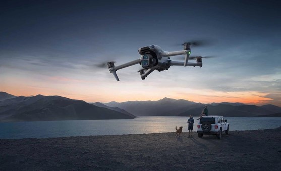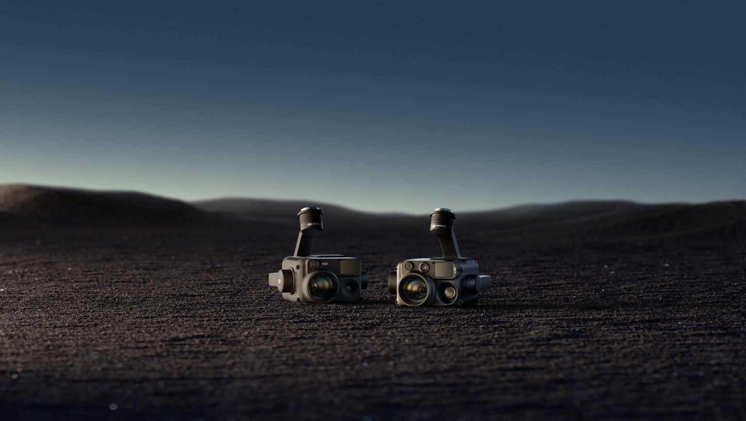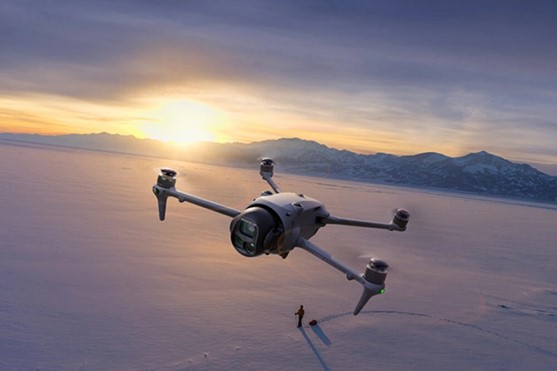

Professional photographers can’t ignore the DJI Zenmuse L2’s groundbreaking features. This advanced system combines a LiDAR module, high-accuracy IMU, and RGB mapping camera on a 3-axis stabilized gimbal. The entire unit weighs just 905±5 grams. Photographers now find they can detect objects up to 450m away at 50% reflectivity, which lets them capture details that standard equipment simply can’t match.
Saudi Arabia’s professional photographers are switching to this technology, and with good reason too. The Zenmuse L2 delivers outstanding results in Riyadh’s commercial districts and the residential areas of Jeddah and Dammam. Business sectors that need extensive aerial photography benefit from its coverage of 2.5 km² in a single flight. The system’s LiDAR performance has improved dramatically – its spot size is now about 1/5 of the L1’s size when scanning objects 100 meters away. This improvement creates sharper and more detailed images that meet the highest professional standards.
What Makes the Zenmuse L2 a Game-Changer
The Zenmuse L2 represents a breakthrough in imaging technology with its remarkable technical capabilities. This device detects objects from 250 meters at 10% reflectivity, which marks a 30% improvement over its previous version. Saudi Arabian photographers now have expanded creative options to work in diverse landscapes.
The system’s spot size has shrunk to 4×12 cm @100m, just one-fifth of what the older model offered. Photographers can now capture fine details in Riyadh’s urban structures and Jeddah’s seaside settings with exceptional clarity.
Quick startup is another advantage of the Zenmuse L2’s self-developed IMU system. Photographers no longer face delays that used to slow down their field work. This feature proves valuable during urgent commercial photo shoots in Dammam’s bustling business areas.
The system’s five returns capability lets photographers see through thick vegetation to capture ground points under the foliage. This feature helps document Saudi Arabia’s varied landscapes thoroughly.
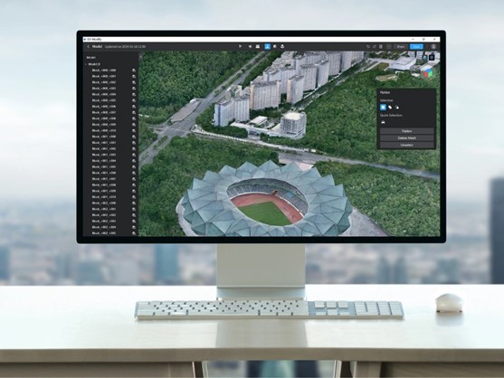
A 4/3 CMOS sensor with 20 MP effective pixels powers the RGB mapping camera and delivers superior image quality. Photographers can check their 3D point cloud models immediately without leaving the shooting location. This immediate feedback streamlines professional workflows at remote sites substantially.
Key Features That Attract Professional Photographers
Professional photographers choose the Zenmuse L2 for its precision capabilities. The camera delivers vertical accuracy of 4 cm and horizontal accuracy of 5 cm, which maintains professional-grade quality across Riyadh’s landscape. The ranging accuracy hits 2 cm at 150 meters, making it perfect for commercial and architectural photography.
The RGB mapping camera’s advanced features include a 4/3 CMOS sensor with larger 3.3 μm pixels and 20 MP effective resolution. These specs create richer true-color point cloud details needed for Saudi Arabia’s high-end photography projects. The camera’s efficiency shines through its minimum photo interval of 0.7 seconds, which lets photographers capture quick sequences along Jeddah’s coastline.
The L2’s five-return capability helps photographers working in Dammam’s dense vegetation by capturing more ground points under foliage. This feature works alongside the point cloud rate of 240,000 points per second, which captures more detailed data quickly.
Field professionals appreciate the camera’s mechanical shutter speed range of 2-1/2000s and its durability with support for up to 200,000 shutter actuations. The three-axis stabilization system with a 0.01° angular vibration range keeps footage steady in tough shooting conditions across Saudi Arabia’s varied terrain. Portable aerial photography systems never achieved such technical specs before the L2.
Real-World Applications and Results
The Zenmuse L2 keeps proving its worth in many sectors. A great example comes from Alpha Survey in South Korea, where they used the L2 to survey a challenging 6.6 km coastal road. Their team turned what would normally take weeks into a five-day project. They worked 3-4 times faster while creating high-quality 1:1000 scale topographic maps.
Utility companies in Riyadh and Jeddah now rely on the Power Line Follow mode. This smart feature tracks power lines on its own and speeds up data collection while reducing human error. The L2’s vegetation penetration capabilities make it perfect for ecological mapping and archeological work, especially in Dammam’s thick forests where it easily captures ground points under dense canopies.
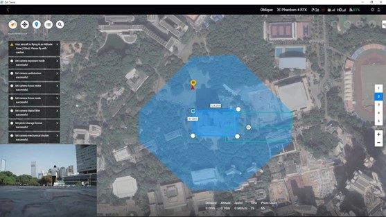
The L2 shows its real power by collecting data at speeds up to 15m/s. Saudi Arabian survey teams can now map 2.5 km² in just one flight, which means projects finish much faster than before.
Road construction teams love the L2’s versatility. They can switch between two scanning modes – repetitive mode for precise point clouds and non-repetitive mode for better penetration. This flexibility helps professionals tackle any project, from Riyadh’s commercial districts to Jeddah’s residential areas.
Conclusion
The DJI Zenmuse L2 marks a remarkable step forward in professional photography and surveying capabilities. Its groundbreaking specs – from the exceptional detection range to the five-return system – bring unmatched precision and efficiency to Saudi Arabia’s varied landscapes. Professional photographers in Riyadh, Jeddah, and Dammam now capture details they couldn’t get with standard equipment and complete their projects much faster than before.
Ground applications show how the L2 reshapes the scene by turning weeks of work into days while keeping high accuracy standards. The system knows how to cut through vegetation, track power lines by itself, and work at high speeds, making it a great tool for professionals of all types. Photographers who just need both speed and quality find the Zenmuse L2 hits all the right marks.
The Zenmuse L2 proves that better technology brings real benefits to photography professionals. A smaller spot size, improved RGB imaging, and up-to-the-minute preview features remove many old workflow bottlenecks. Photography professionals throughout Saudi Arabia see these benefits clearly, which explains why so many have switched to this revolutionary system. Anyone interested should head over to Abdulrahmanl Alshareef Group to try these features themselves.
The Zenmuse L2 isn’t just another upgrade – it’s a radical alteration for professional photography. LiDAR precision, instant readiness, and exceptional imaging quality come together in a system that delivers clear advantages in every way that matters to professionals. This powerful technology gives photographers results they couldn’t achieve before, expanding their creative options while making their business more efficient.